By: Patrick Cooney and Brice Crayne
Losing an organ, gaining an opportunity
In the summer of 2018, I had an opportunity so rare and awesome, I violated every post-operation restriction the surgeon put on me in order to participate.
“Take it easy and don’t lift anything over 10 pounds for at least a month,” the doctor said as I lay drugged, cold, and sore on the hospital bed following an emergency surgery that left me without my gall bladder.

Rewind a few days from the hospital bed, and one would have seen a much happier and excited me. While on the phone with a colleague with the Lower Columbia Fish Enhancement Group, he described an amazing project he was working on. He and his colleagues were taking incredible steps to open up miles of beautiful spawning habitat for Steelhead Trout in the Washougal River, a tributary to the Columbia River in southern Washington near the mouth of the Columbia River Gorge. Steelhead Trout migrate to the ocean and return several years later to the freshwater stream where they were born in order to spawn and reproduce. Migration barriers are one of the leading causes of declines in Steelhead Trout populations. Removals of those barriers are critical to long term Steelhead population recovery, especially for threatened populations, like those in the Washougal River.

I inquired about helping on the project in order to contribute to the river recovery project while also wanting to test out a newly engineered backpack electrofisher. Without hesitation, my participation was solidified and the date was set for two weeks out. Then boom, the gall bladder pain hit me like a hot knife to the abdomen, and my participation was in question.
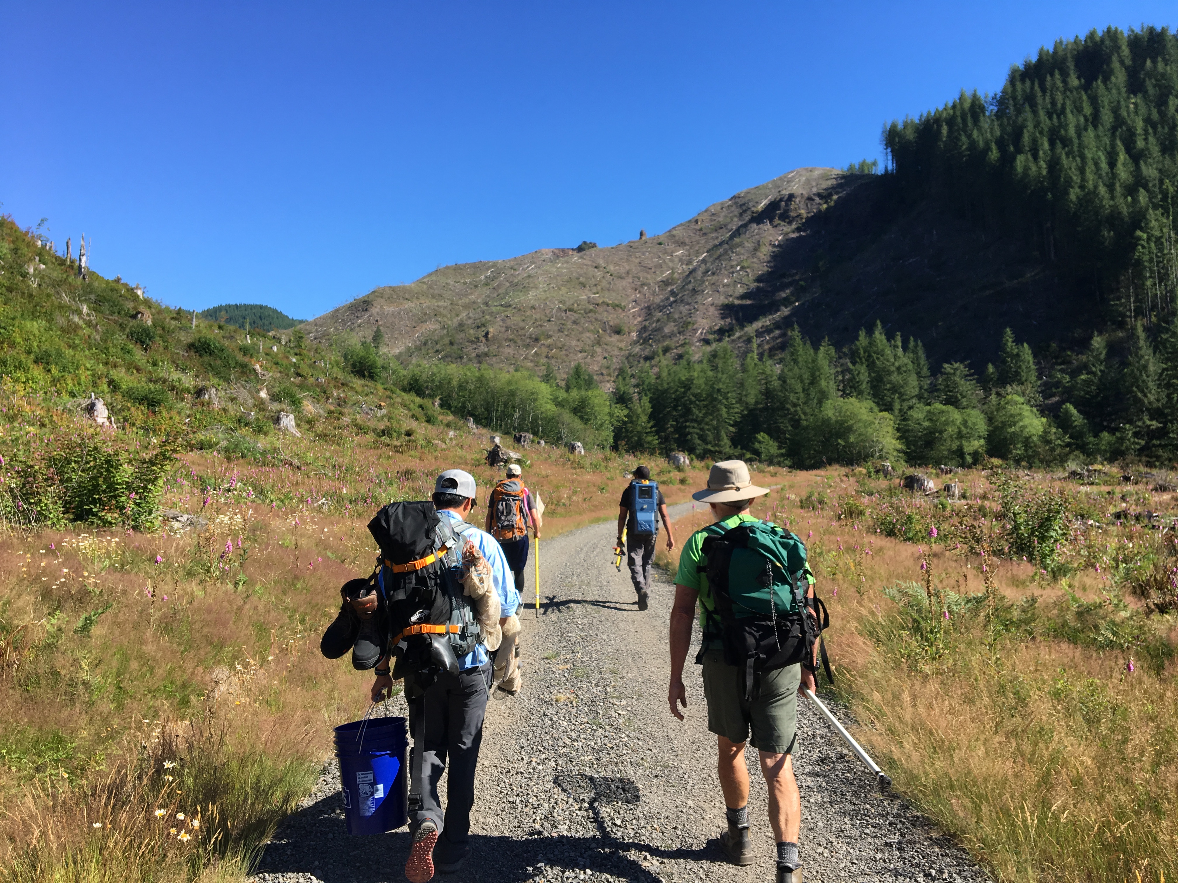
Down an organ and a few days of recovery under my belt, I decided I was not going to miss this opportunity. If anything, the fish salvage helped speed up my recovery both physically and mentally. I was going to take that epic, leg burning hike into the headwaters of a beautiful river while carrying 30 pounds of supplies and technology on my back. Yes, I decided I would violate everything the surgeon told me not to do in order to help fish and see some of the largest logs I had ever seen in the Pacific Northwest of the United States.


Man-made log jams block creek
A recent fire burned through the northern edge of Oregon in the Columbia River Gorge in September of 2017 after teenagers purposely threw firecrackers off of a steep trail along Eagle Creek, another tributary to the Columbia River. Ironically, 115 years earlier, teenagers in Eagle Creek were trying to burn out a wasp nest and accidentally created the Yacolt Burn of 1902. The Yacolt Burn is considered among the worst fires in US history. Darn history loves to repeat itself.
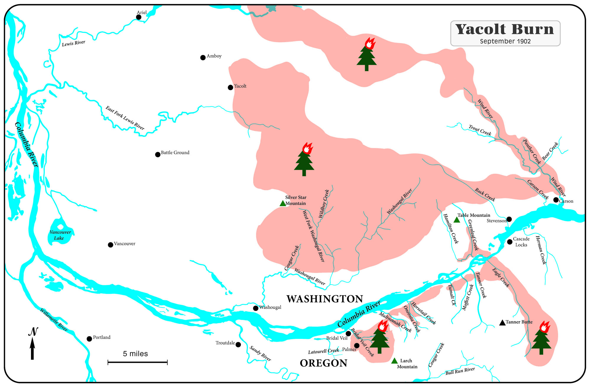
The Yacolt Burn burned much of the same forest in Oregon as the more recent Eagle Creek fire, but also burned over 100,000 acres of virgin old growth forests in Washington. Yes, that fire was so large, it jumped the Columbia River and devastated the logging industry of southwest Washington. The massive charred trees that were victims of the Yacolt Burn stood for more than 50 years before man would come through and dislodge them into the streams where they would wreak havoc on the local fish populations.

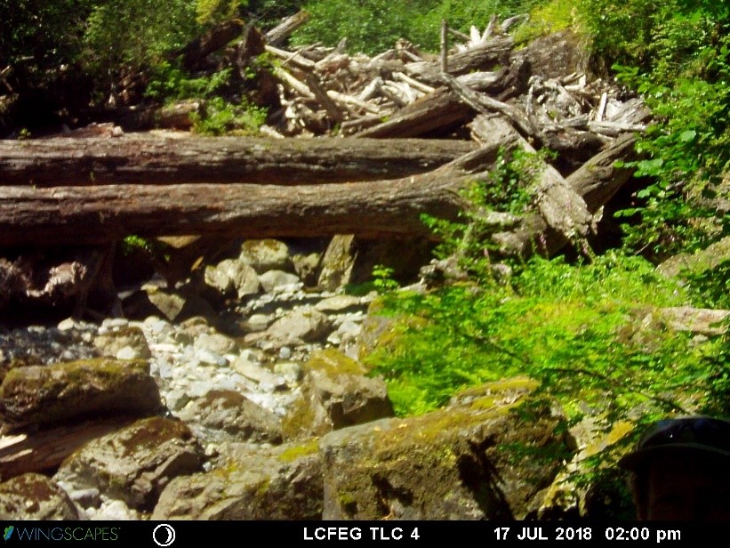
In order to float the large logs downstream, the river bed was scoured by heavy equipment and check dams were installed along the course of the river. As the logging practices were abandoned, many of the old growth logs that were left behind mobilized in heavy flows and lodged at pinch points in the river, creating massive and impenetrable barriers.
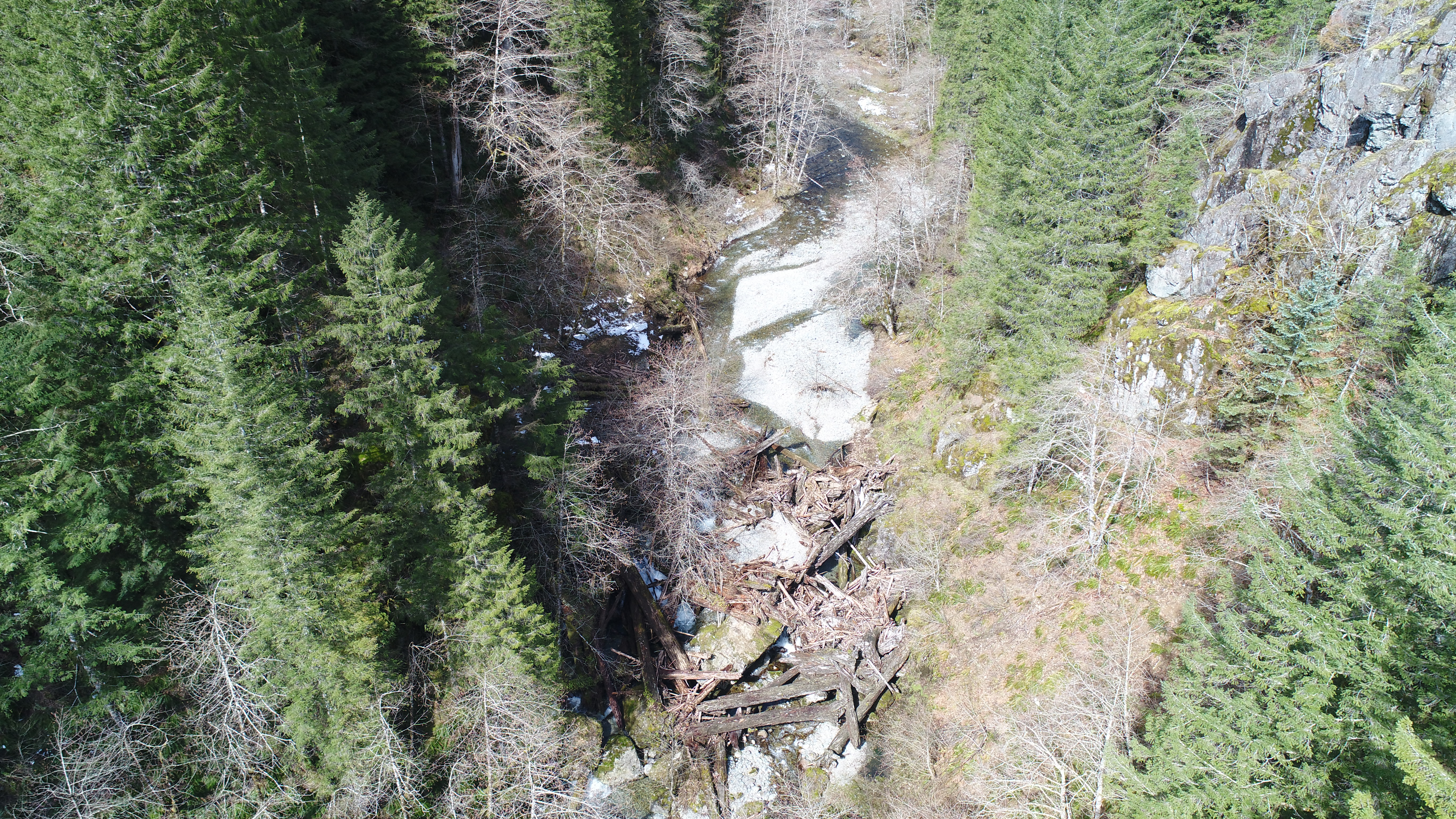

Additionally, a quarter mile of stones backed up behind some of the log jams and forced the river to go subterranean. It quickly became apparent why migratory fish were no longer able to gain access to once thriving spawning habitat in the upper reaches of the Washougal River.
An assessment in 1997 noted:
“…large log jams … have become cemented with gravel accumulating behind the jams. The condition of these jams needs assessment, as the jams potentially restrict passage, and block the movement of gravel to downstream reaches.” (Source)

Log jams have blocked Bluebird Creek for 50 years, and gravel backed up behind the log jams force the creek to go subterranean for a quarter mile. Skamania County, Washington. Photo: Patrick Cooney
The Lower Columbia Fish Enhancement Group received funding to break up the log jams and provide access for fish to the upstream spawning habitat. However, in order to carry out this task, they needed to bring in heavy equipment. Prior to driving heavy equipment in the river bottom, all of the fish needed to be removed from the work site to minimize any further harm. This is where my help and access to electrofishing equipment was most needed.
Exploring new technologies
The pack I was carrying was not your typical pack. It was a new invention I had been working on for a couple of years in conjunction with a team of engineers. It represented a significant advancement in electrofishing technology created for scientists on the front edge of assessing, conserving, and managing fish populations. To put the equipment to the ultimate test, I needed some of the gnarliest terrain and slot canyons I could find to best evaluate the GPS and data logging capabilities of the advanced electrofisher.
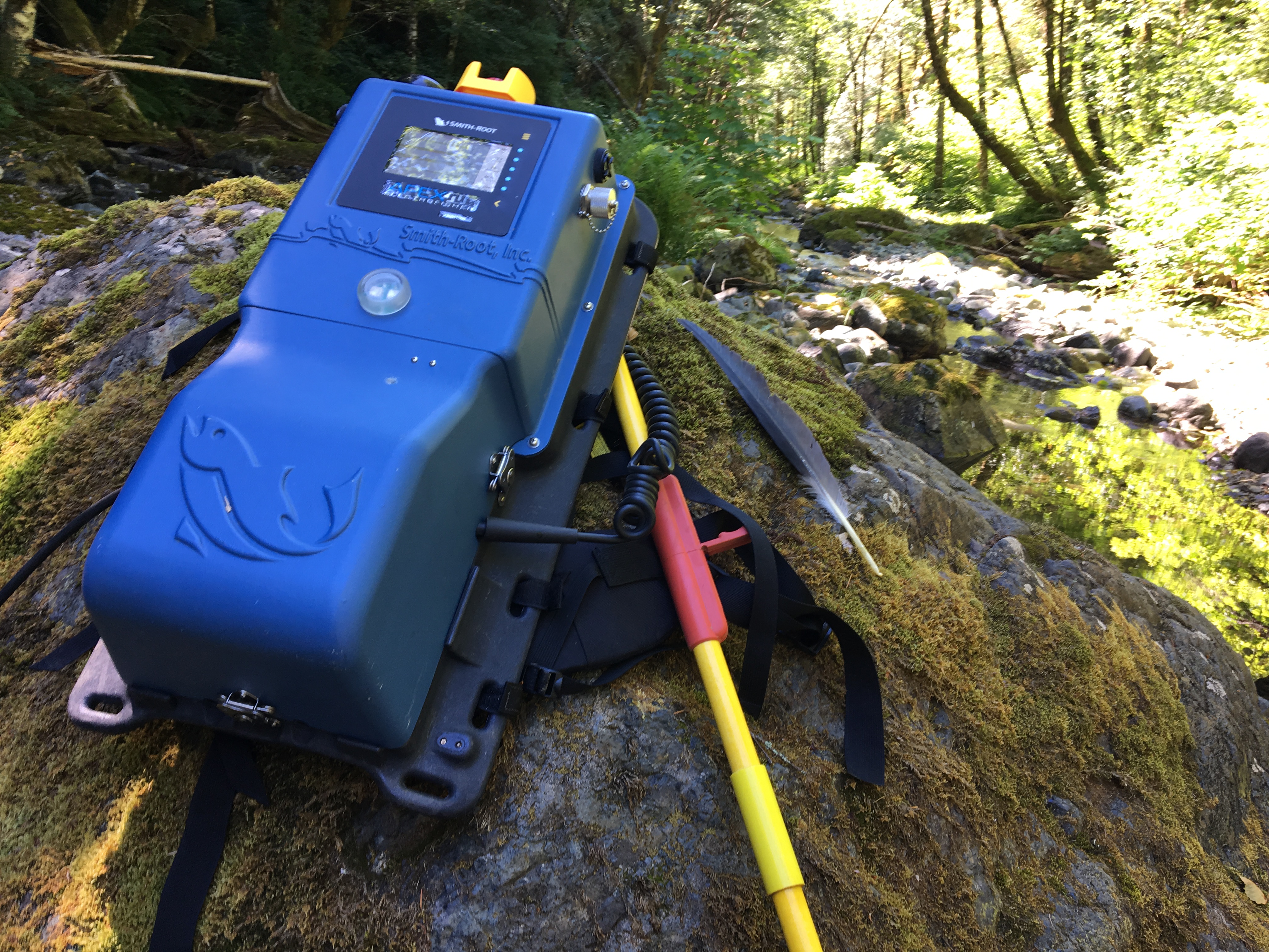
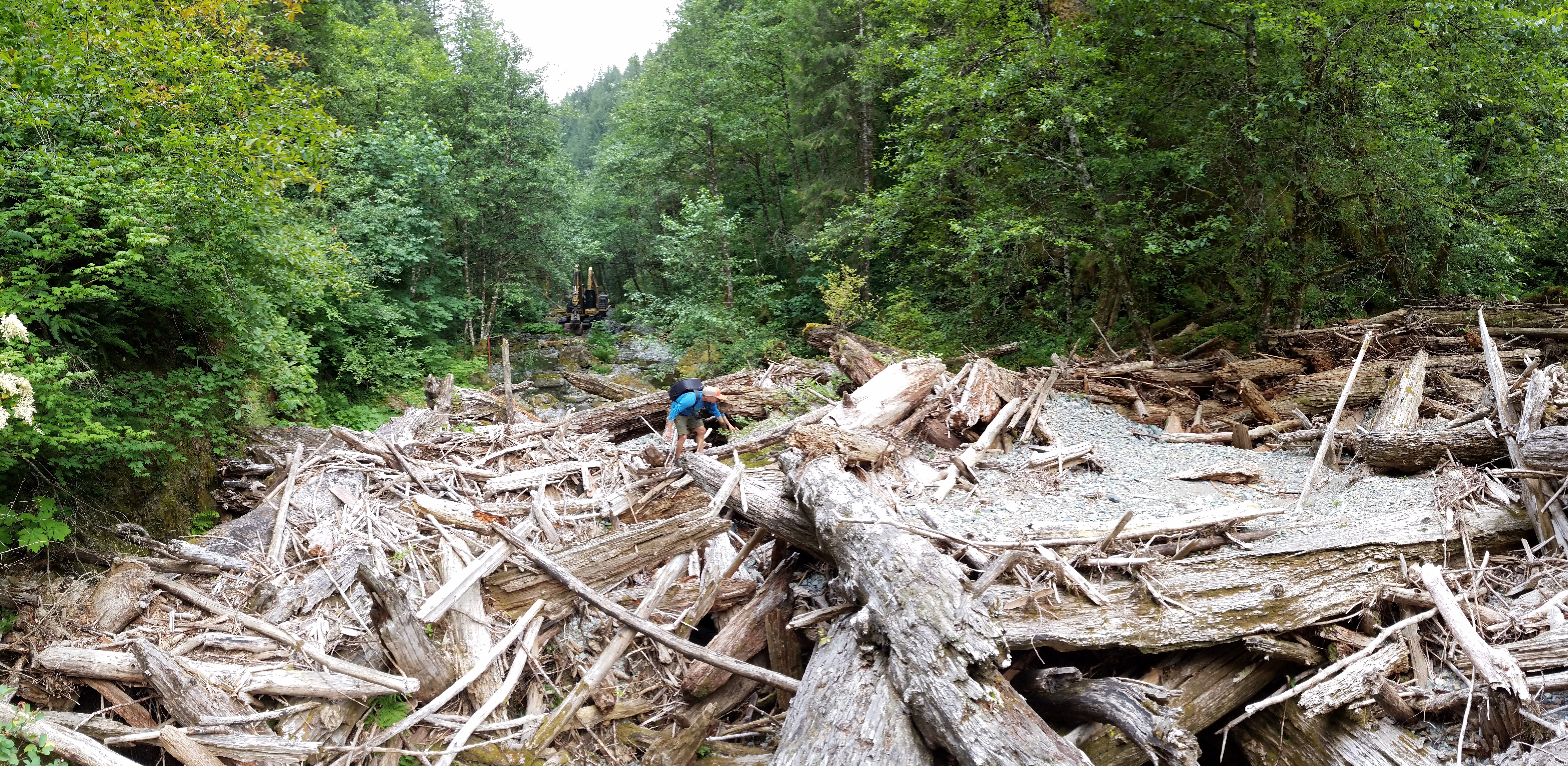
Bluebird Creek, a tributary located in the headwaters of the Washougal River, had two of these log jams and also had gnarly terrain with steep riparian slopes that all laid out perfectly for evaluating the capabilities of the new equipment. Bluebird creek is where the Lower Columbia Fish Enhancement Group was heading. I was all in.

Besides evaluating the performance of the new equipment, it was incredible to participate in this project because of the long history of the fish migrations on the Washougal River and the people who lived in the region the once relied on these sustainable fish migrations for survival.
History of the Washougal
Prior to European arrival, the Washougal River was inhabited by the Washougalles, a tribe of Chinook Indians, who enjoyed the spoils of year-round runs of Salmon and Steelhead. They also hunted the seals that congregated in this area because of the abundant fish populations. Accordingly, Lewis and Clark titled the Washougal River as “Seal River” and “Sealcalf River” during their adventures.
“…a Small river falls in about 80 yards wide and at this time discharges a great quantity of water [Washougal River]. The nativs inform us that this river is very Short and heads in the range of mountains to the N E of its enterance into the Columbia the nativs haveing no name which we could learn for this little river we call it Seal river [Washougal River] from the great number of those Animals which frequents its mouth. this river forks into two nearly equal branches about 1 mile up and each branch is crouded with rapids & falls.” -Clark, March 31, 1806

The seals no longer congregate at the mouth of the river where a massive paper plant has been in operation since 1883, and the fish runs are a small fraction of their original size. Programs like the Lower Columbia Fish Enhancement Group aim to reverse these trends through habitat improvements.

Fish Removal
Five of us set out on an epic journey, climbing up old logging roads, passing through fern forests, and descending into the river bottom. Along the route we found evidence of old logging practices.

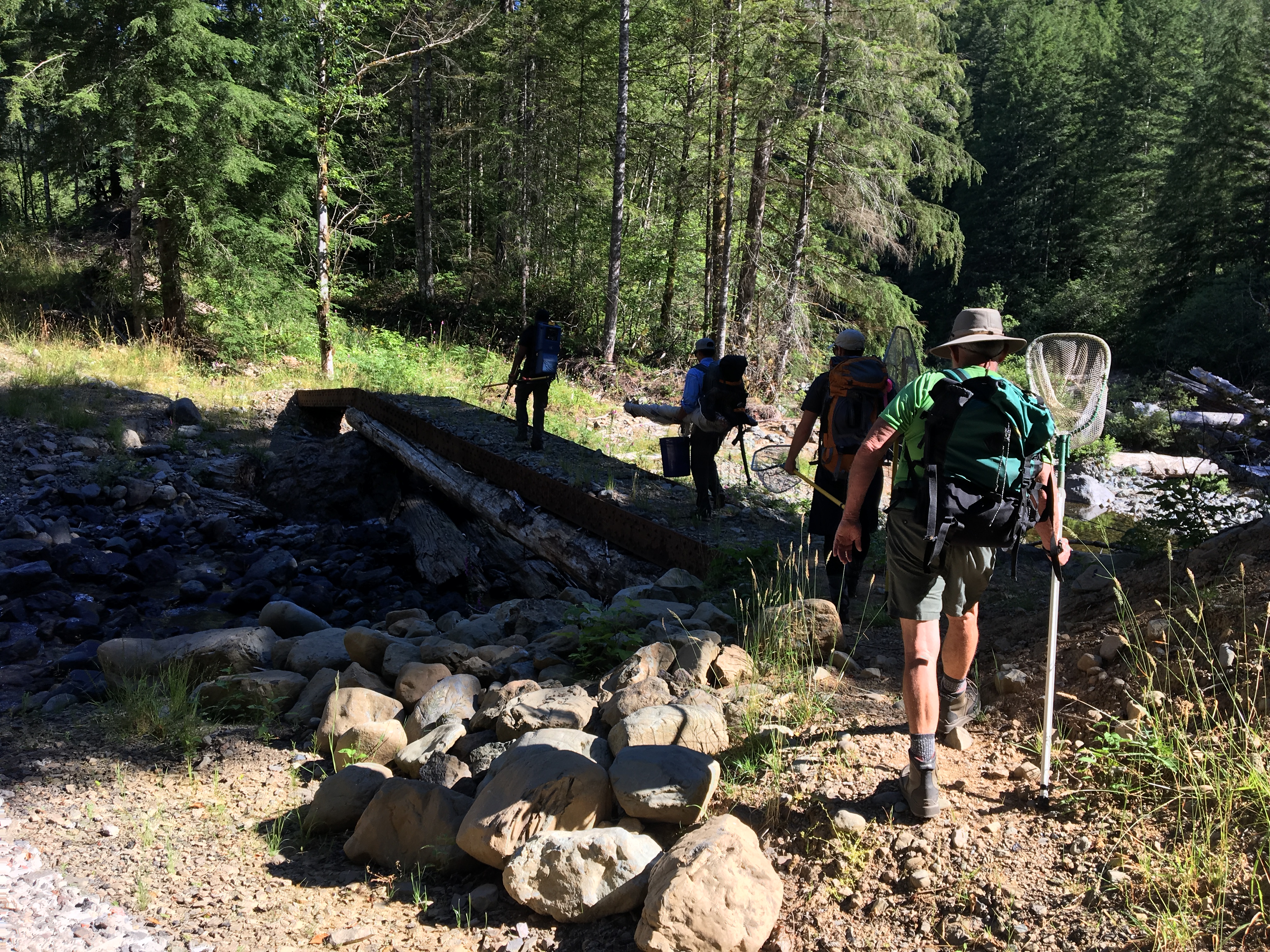

The water of Bluebird Creek was so clear, the sediment load so minimal, and the fish were isolated in distinct pools, that we were able to electrofish from upstream to downstream without worry that we would make the water turbid or that fish would escape. It is a rare occasion to find such a stream and is a great indication of amazing spawning habitat for salmon and trout.


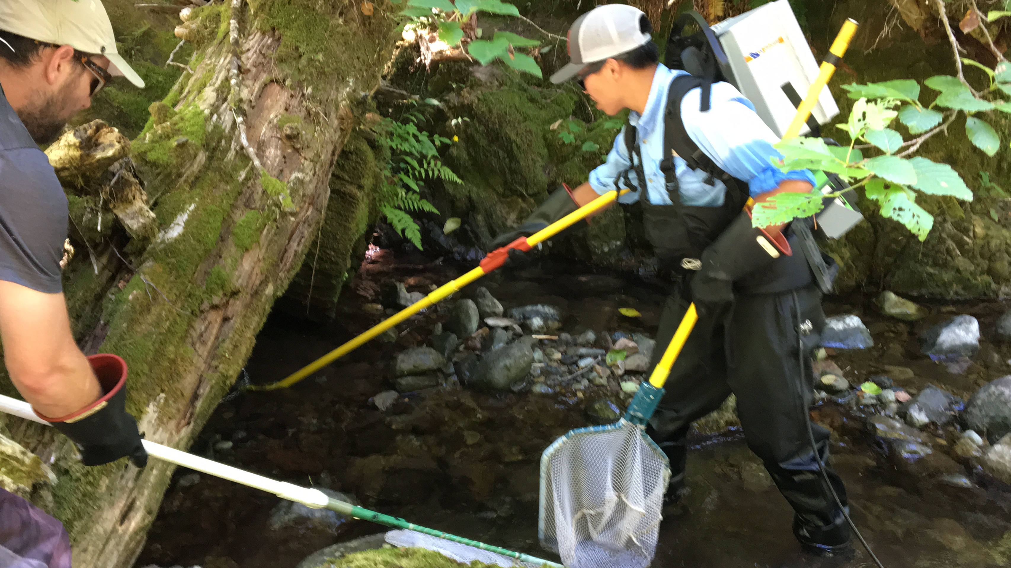
To capture fish, two people wore backpack electrofishers, two dip netted fish, and one person managed the aerated buckets and instream livewells. During the day, we encountered at least four species of fish (several sculpin species, Cutthroat Trout, and Rainbow Trout), giant Pacific salamanders, and Coast Giant Salamanders, and handled about 200 critters in total.


Electrofishing entails applying a very specific electric current to the water to temporarily immobilize the fish where they can be scooped up and placed in an aerated bucket where they rapidly recover. The ability to use this equipment in this region of the world is heavily regulated and only allowed when done properly by licensed and permitted scientists.
The newest technology successfully tracked our electrofishing efforts over the half mile where we collected fish despite the deep canyons and difficult terrain. Each dot on the map indicates a second of electrofishing effort and the different colors correspond to the electrofishing settings used to succeed in the differing habitats.

Removing the log jams
Following the removal, fish were unable to re-enter the defished zone by a gravel bar plain on the upstream end and a blocknet stretched across the mouth of Bluebird Creek on the downstream edge where it flows into the Washougal River. The Lower Columbia Fish Enhancement Group was ready to break ground. Working with Mike Watters Excavation, we walked two 330-class excavators across the Washougal, up an old logging road, back across the Washougal, through the Bluebird Creek alluvial fan, and into the lower end of Bluebird Creek.

We started out pushing up an sand and gravel barrier at the bottom end of Bluebird Creek and re-routing the flow into hole we dug in the alluvial fan; this way, all the turbidity that we created as we dismantled the dams would settle out before it reached the Washougal River.

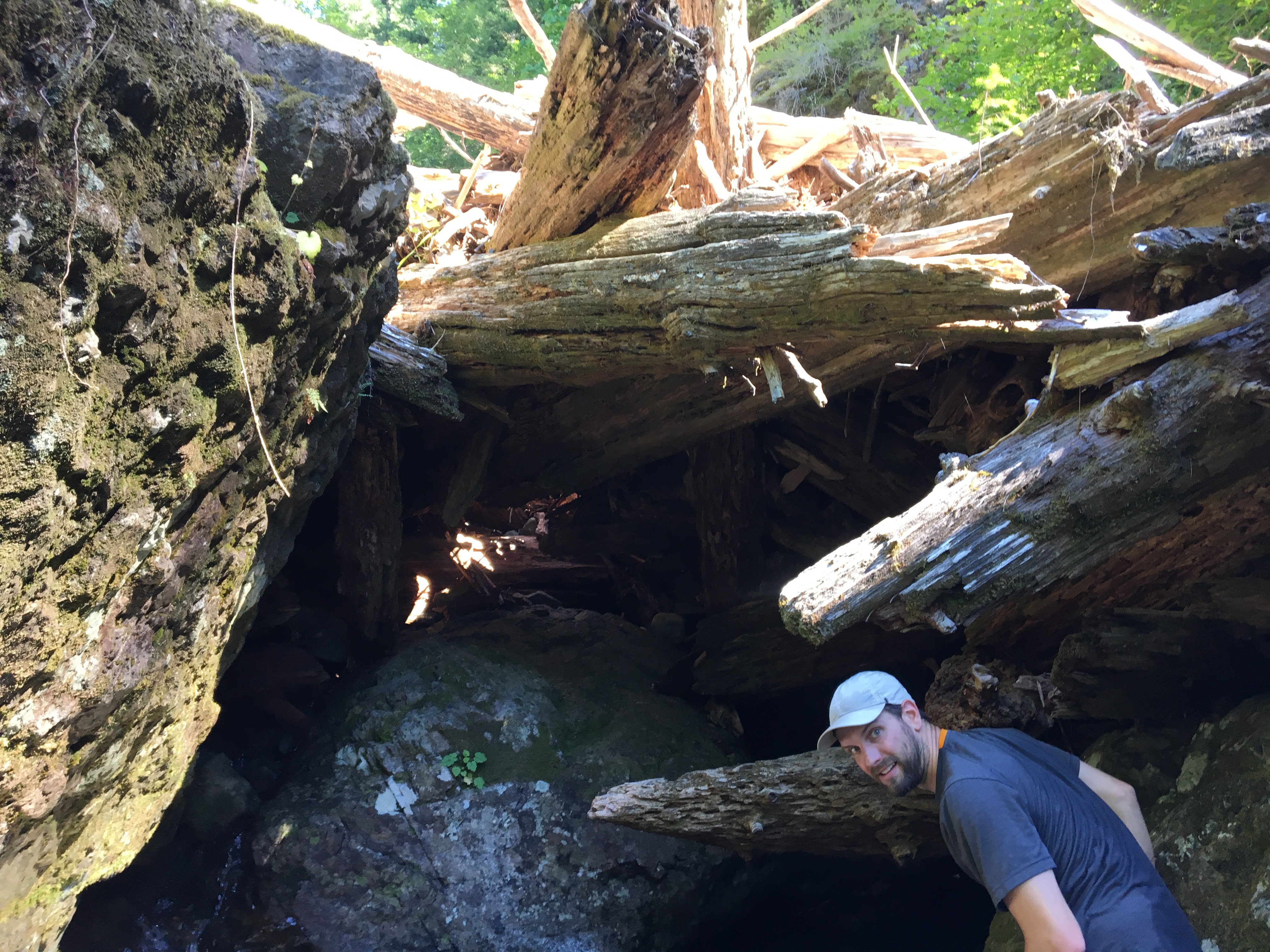
We walked the equipment right up the creek bed. One excavator outfitted with a rock hammer (330-D), the other with a clam-shell attachment with hydraulic jaws (330-FM). The first jam was about 400’ from the confluence with the Washougal.
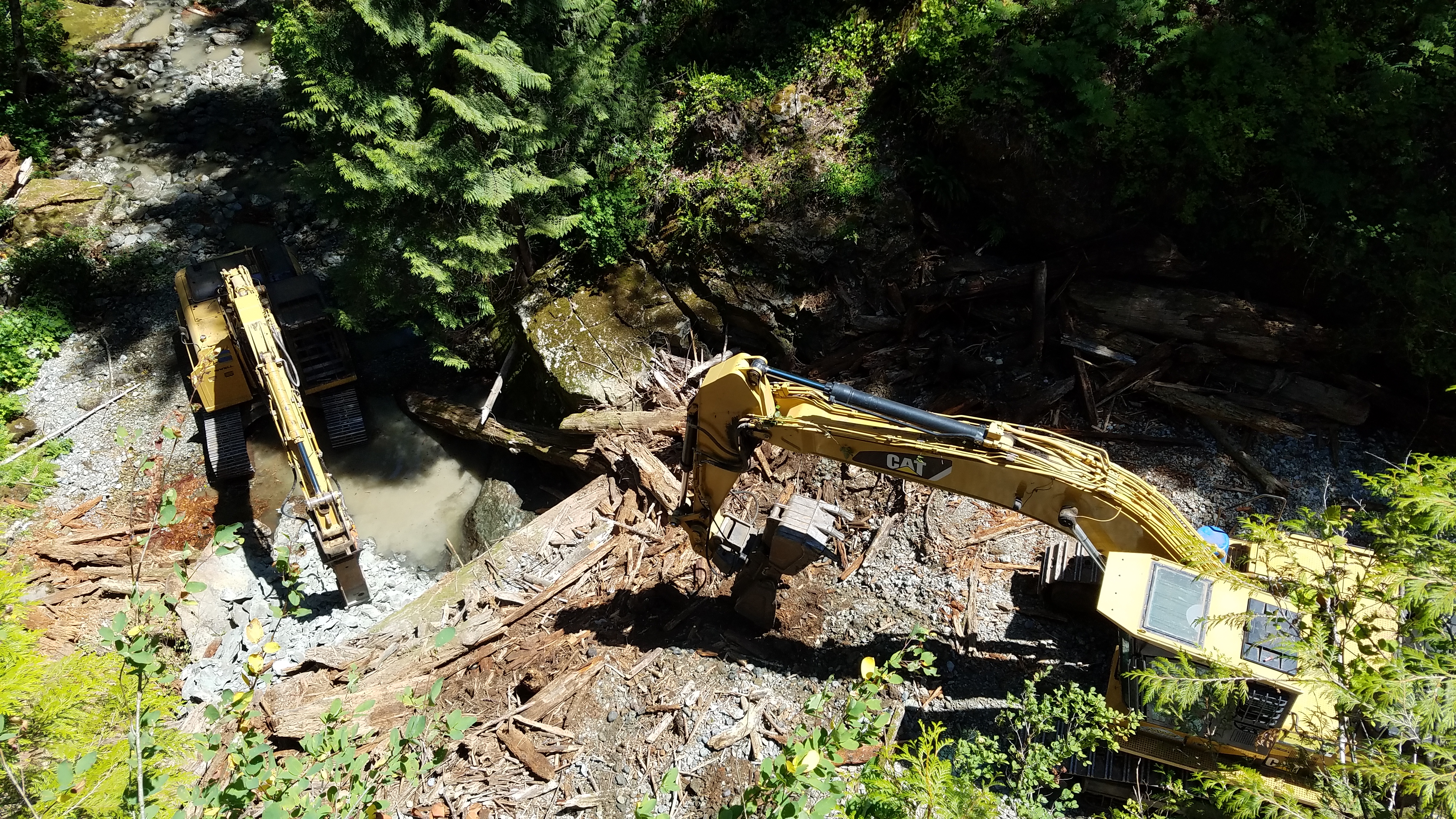
The FM picked it apart, setting large pieces aside for future use and using smaller broken pieces to build a ramp up and over the jam; it only took him 45 minutes to get a 100K lb. excavator over the lower jam. The team worked together to dismantle the first jam just enough to safety navigate over but we left it mostly in place to use as a filter for any turbidity coming out of the upper worksite.
By day two, both jams were dismantled and the contractor, Lower Columbia Fish Enhancement Group project manager, and two engineering firms all discussed the pros and cons of material placement. We had 15,000 cubic yards of sediment and 5,000 cubic yards of woody debris to sort through and place in a strategic manner.
We didn’t want all the wood from the upper jam to flow down and reform the barrier in the lower nick point. We didn’t want to stage the spawning gravel and other sediment in a place where the creek couldn’t get to it. What we wanted, was a complex set of step pools creating a series of pools and riffles from the upper watershed to the mouth. We spent the next two weeks sorting through the buried sediment for large key pieces that could be unseen barriers, staging smaller woody debris and rock in strategic places where the creek could take it piece by piece over an estimated 5-10 years, and using the larger pieces to build channel-spanning woody structures in Bluebird Creek from the upper jam site to the confluence. The end product wasn’t pretty. We had mounds of rock and wood staged up in the sediment plane above the upper jam and below the lower jam. But we had connectivity, a good plan, and a series of time-lapse cameras to watch the material move throughout the winter.
Upper log jam on Bluebird Creek pre-construction. Brice Crayne
Upper log jam on Bluebird Creek during construction. Brice Crayne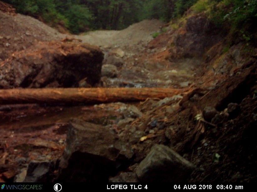
Upper log jam on Bluebird Creek immediately following construction. Brice Crayne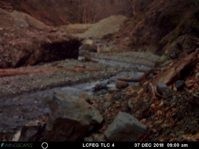
Upper log jam on Bluebird Creek 3 months post-construction. Brice Crayne
As of December, 2018 we only had one high water event, which according to the gauge at Hathaway Park, never even hit 10K cfs and would only be categorized as an ordinary high water event. That said, a site visit in late December showed that our 5-10 year plan of exporting the material had been an underestimate. Bluebird Creek had already moved about 90% of the staged sediment out of the upper worksite and 70% out of the lower worksite. All of the channel-spanning structures were filled to the brim with new spawning-sized gravel with beautiful plunge pools below. We did our part to free the sediment and wood, and the creek responded beautifully. Now, we wait for the fish.

Upper Bluebird jam site showing an open, flowing creek with minimal material remaining to export. Photo credit: Brice Crayne 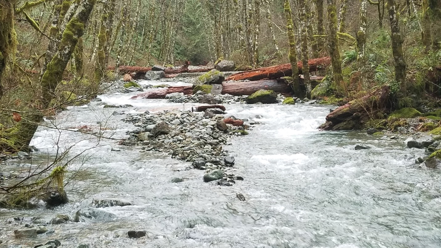
Large wood placed in Bluebird Creek between the upper and lower dam sites has created a dynamic creek connected from toe to toe. Photo credit: Brice Crayne 
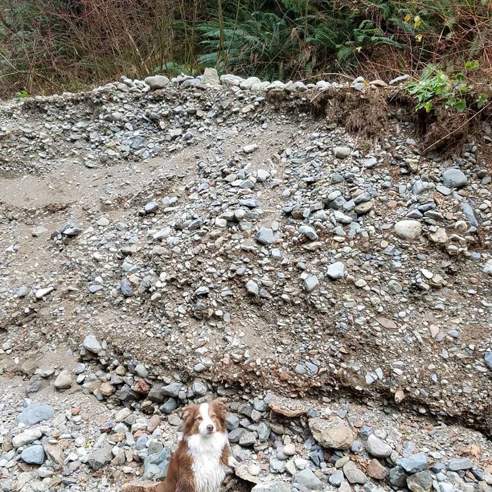
Photo looking upstream at where the sediment plane used to be at the lower worksite; the person and dog are walking along the pre-construction sediment backed up behind the old log jam. Photo credit: Brice Crayne
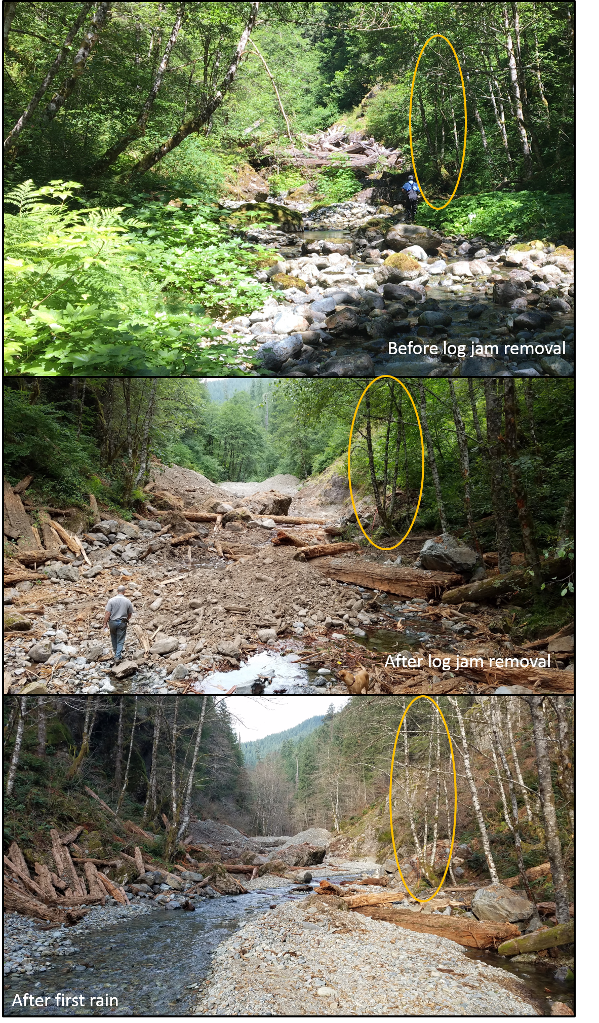
Before removal, after removal, and after the first rain at the upper log jam on Bluebird Creek. Note the same tree circled in yellow. Additionally, note the amount of stone and wood that were redistributed following the first rains. Pictures: Patrick Cooney and Brice Crayne

I thought the article tell about human-made dam liquidation. What is this situation there?